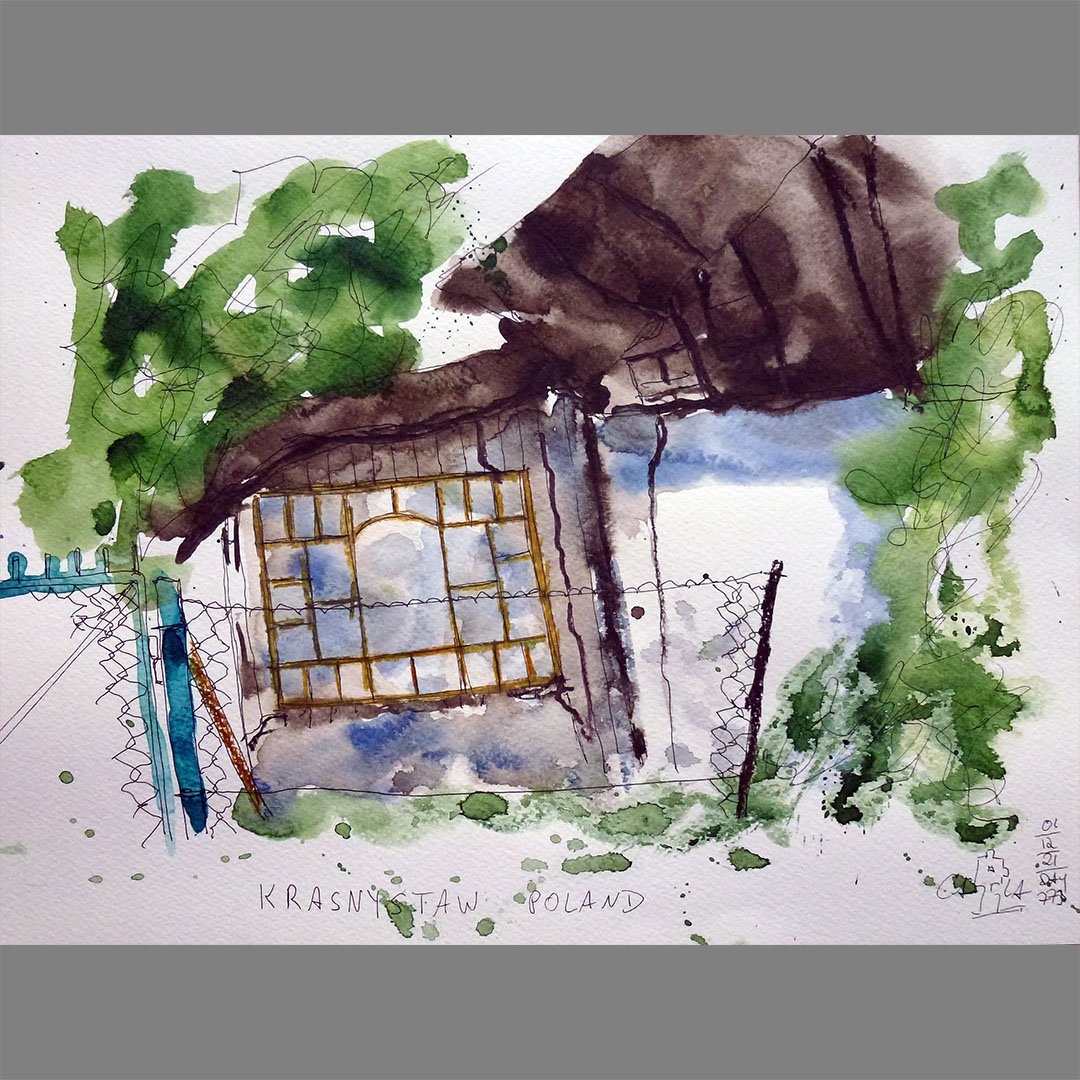
Krasnystaw
The way to my next stage destination N51.00.000 E024.00.000 leads through the historical city of Krasnystaw, which is famous for a hop and beer festival called Chmielaki, but also for dairy products. On my virtual bike route through a small street on the outskirts, I notice a particularly beautiful window on an old, dilapidated house that doesn't really match the small wooden annex.
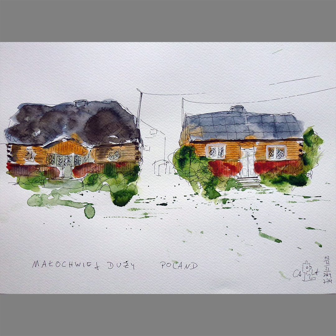

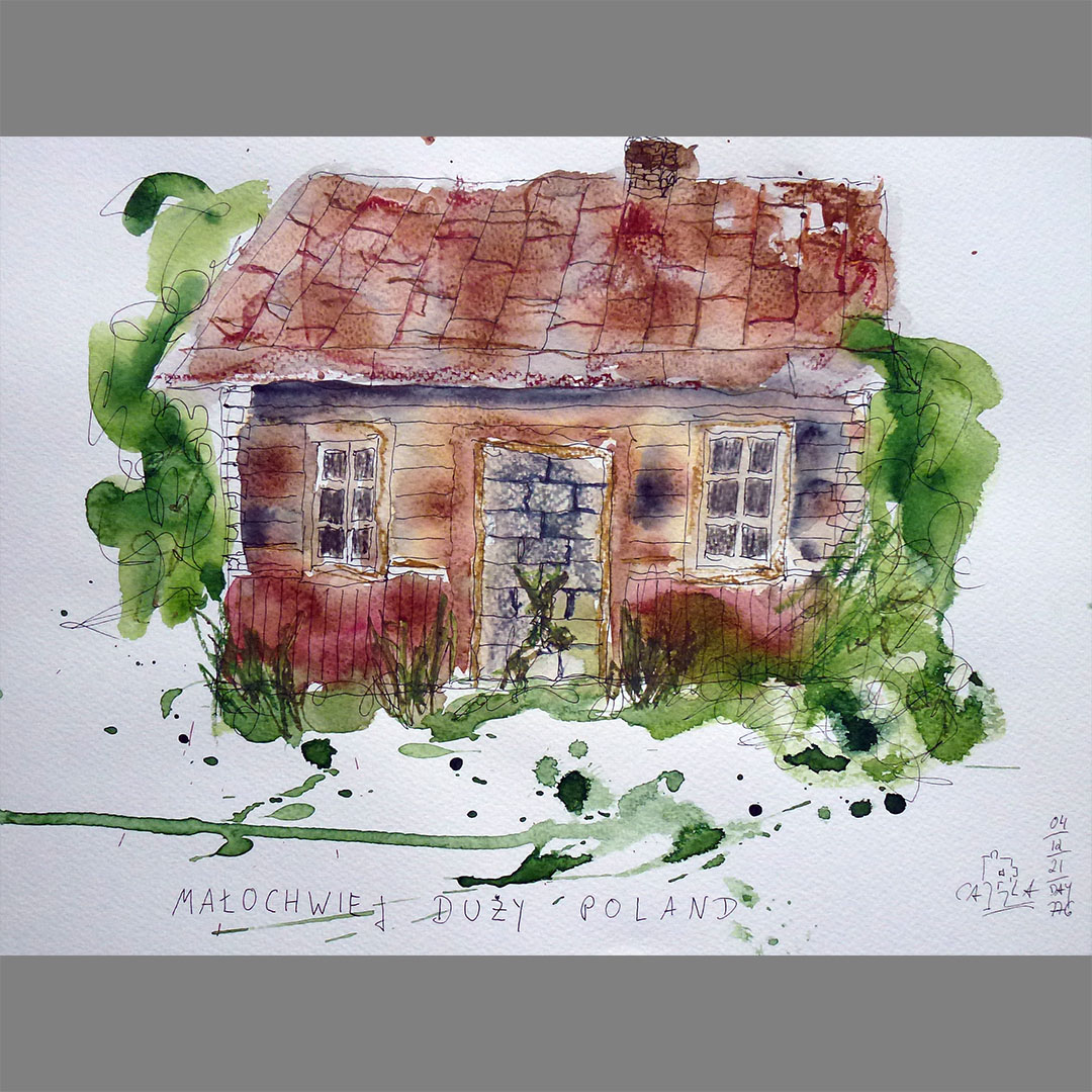
Małochwiej Duży
My further way to N51.00.000 E024.00.000 leads through the village Małochwiej Duży, in which there are many old wooden houses, all of which have the same architectural style and come in two variations, a smaller shape with a gable roof and a slightly larger one with a hipped roof. Many have the same paint, ocher-colored above, dark red below the edge of the window. Some have decorations on the corners of the house, some have a small porch. Almost every third house appears abandoned or is for sale and the abandoned houses appear in different stages of decay. In a house that looks very shabby, only the meticulously tended vegetable garden suggests that it is still inhabited.
Locations:
https://goo.gl/maps/Ly2ghEQA4iCs6zkT9
https://goo.gl/maps/wWaY7Y22QPMRw7RA8
https://goo.gl/maps/r7UtnzABPBcKjia17

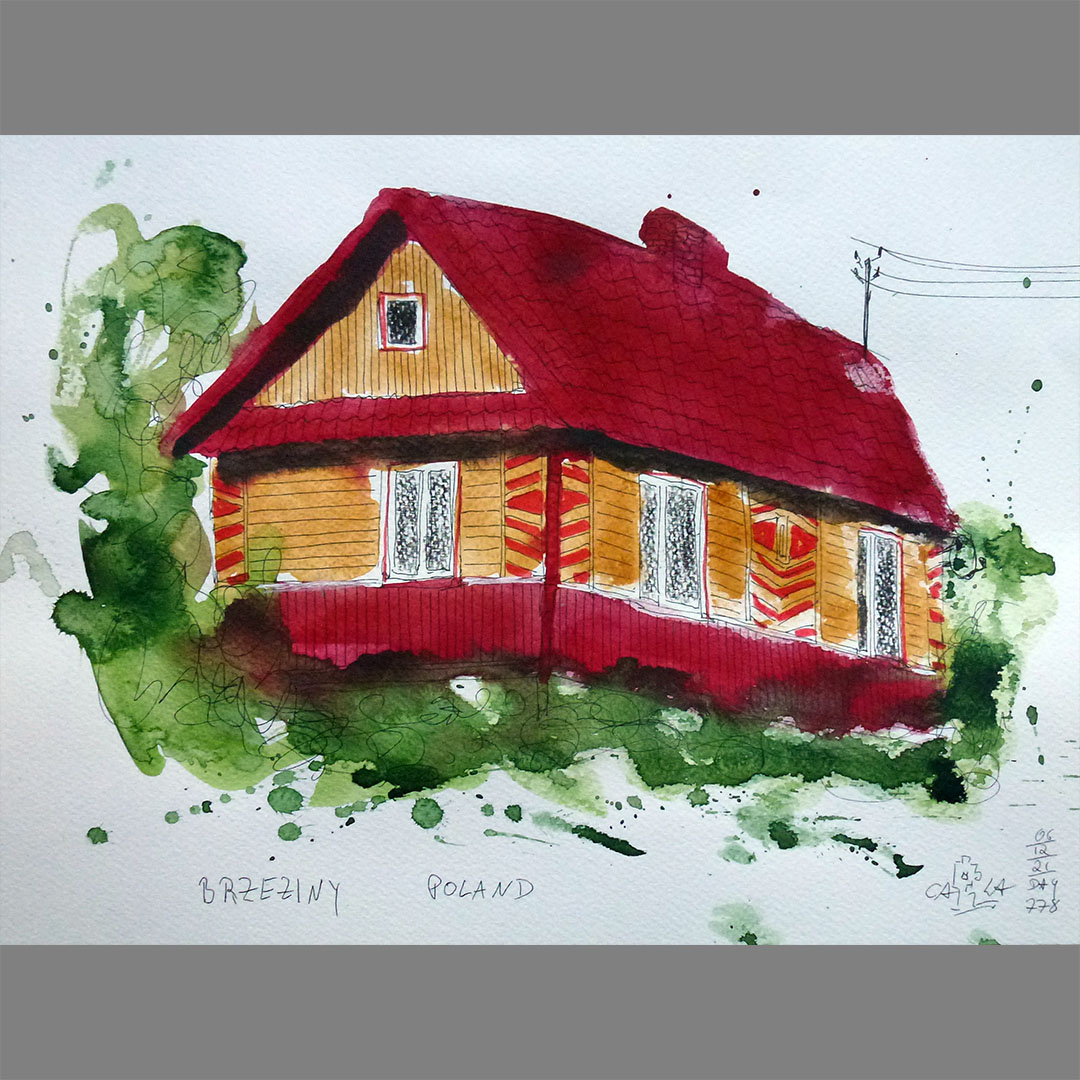
Brzeziny
In the next village Brzeziny in the direction of my stage destination N51.00.000 E024.00.000 there are several well-preserved or even freshly restored houses in the typical construction.
Locations:
https://goo.gl/maps/Rj9PQyFYzGiqetgr5
https://goo.gl/maps/Hxe8HG3LoFt7rbC68

Bończa
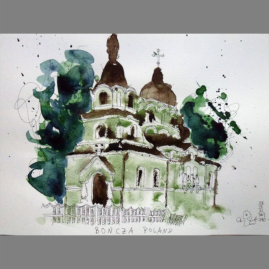
On the way to N51.00.000 E024.00.000 my virtual bike route leads between 2 churches in Bończa. On one side of the street is an Orthodox church from the 19th century, opposite a Catholic, formerly Calvinist church from the 15th century.
Locations:
https://goo.gl/maps/1PXPDkNxJaAMp9gQ8
https://goo.gl/maps/54scHxsYZfeQUkZW6
Wojsławice
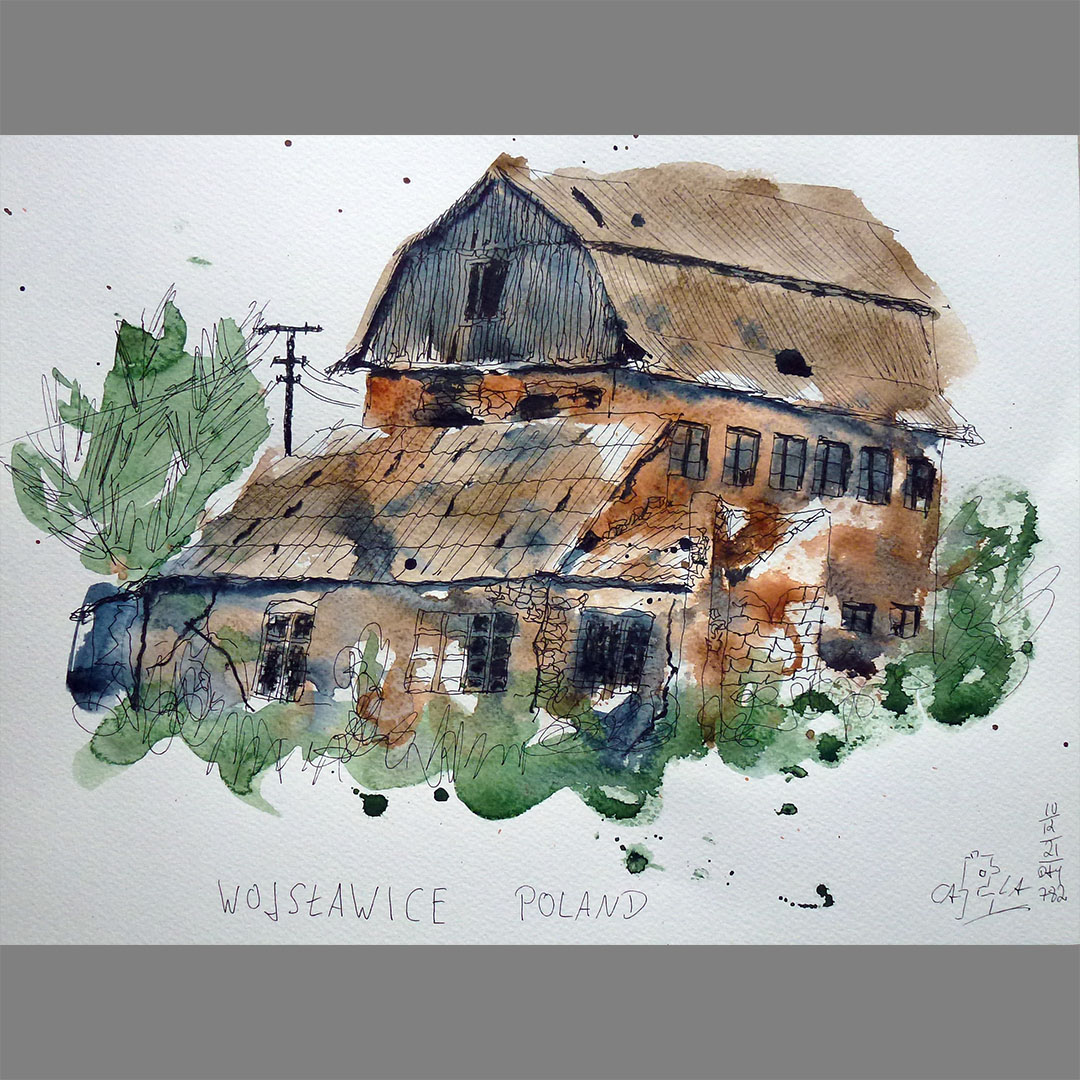
On the further way to N51.00.000 E024.00.000 on the outskirts of Wojsławice I notice a decaying building that is marked as an old mill on the map. Unfortunately I couldn't find out what was being produced here, but the view of this Lost Place is enough for me to draw.
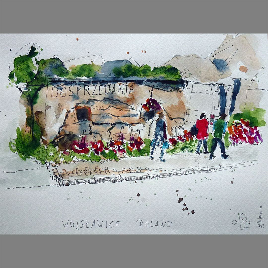
There is a market at a crossroads in the town center of Wojsławice. Traders have spread their goods in courtyard entrances and on the sidewalk, and a florist uses this lost place for sale as a presentation area for his hanging flower baskets.
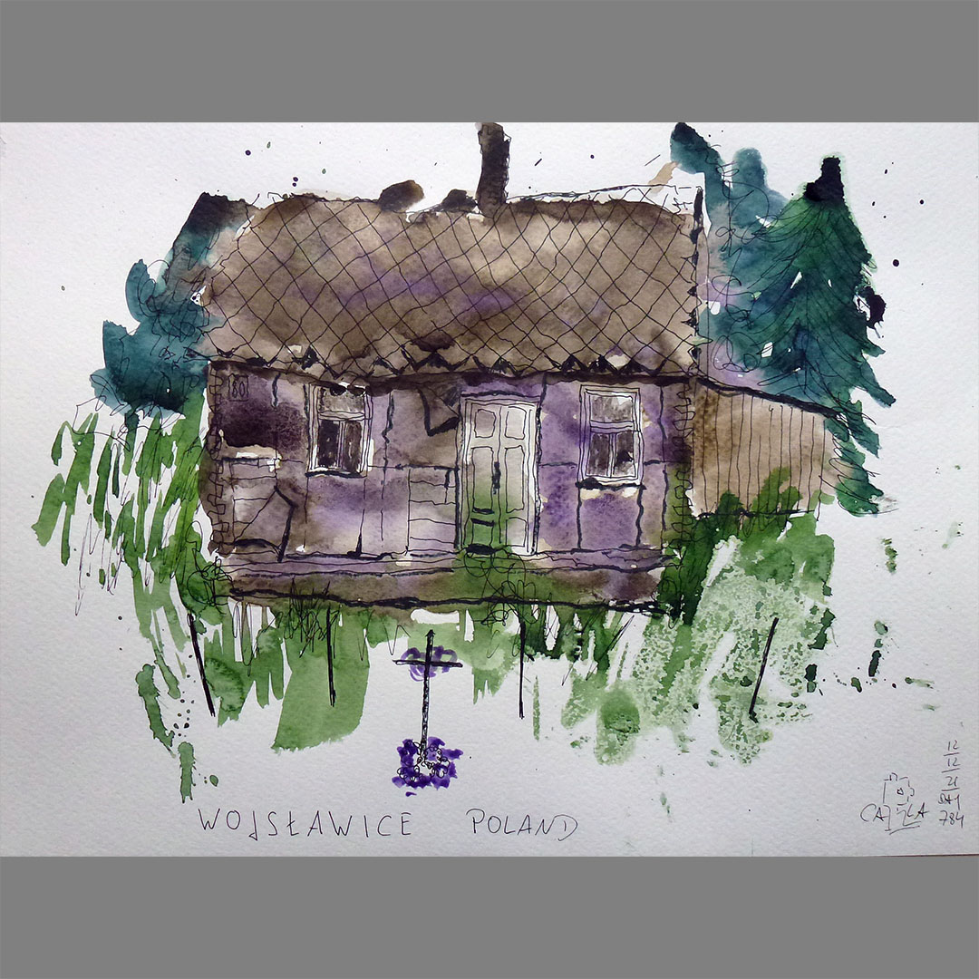
It looks like someone set up a cross for the dying house in Wojsławice. But it's probably more of a coincidence, every few meters along the streets there is a crossroads, a chapel or a wayside shrine.
Locations:
https://goo.gl/maps/D17iMiAfC8j6o2Kq7
https://goo.gl/maps/CF63yzSFJV6p8pMo6
https://goo.gl/maps/DXki5CUsAsNL16TA8
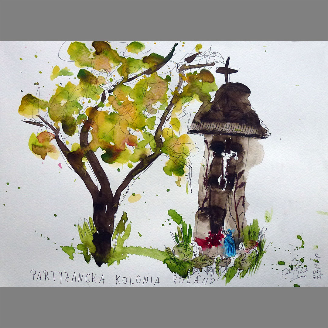
Partyzancka Kolonia
In the Polish folk religious tradition, a series of roadside shrines was created called "Bożamęka" which means "God's mourning". The name comes from the ethnocultural region Kociewie in the historical Pomeranian region in northern Poland. This one in Partyzancka Kolonia on my way to N51.00.000 E024.00.000 is a typical example in a quite original form integrated into a tree trunk.


Janki Dolne
On my further virtual bike route to N51.00.000 E024.00.000 I notice this abandoned old house in a wild garden in Janki Dolne. Right next to it is an identical house, freshly painted and with a new roof, in a carefully tended garden. A typical picture that struck me again and again in the villages and small towns on my entire virtual route across Poland along 51 degrees North latitude.

N51.00.000 E024.00.000
My next stage destination N51.00.000 E024.00.000 is directly behind the border between Poland and Ukraine in an extensive forest area. Although it is only approx. 5 km as the crow flies from the border, the route from the border crossing Zosin - Ustyluh over the border river Bug leads initially over a forest path approx. 20 km to the north. There is only one documented visit to the confluence point in February 2006 and those are the only photos I could find. Bicycle routing is not possible in Ukraine, but the same forest path is indicated for cars and pedestrians.