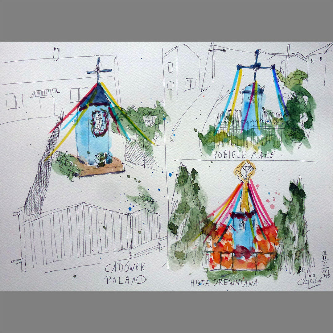
Blue wayside crosses
My virtual bike journey along 51 degrees North latitude continues. On my way from N51.00.000 E019.00.000 to N51.00.000 E020.00.000 I pass a wayside cross in almost every village. Many are light blue, decorated with a statue of the Virgin Mary and decorated with colorful ribbons.
Locations at google:
https://goo.gl/maps/PqB6TAFhEwyx3mXx6
https://goo.gl/maps/BffdFaPubKSLiqqA7
https://goo.gl/maps/G6CNm8BPsEwQL3Er6
N51.00.000 E020.00.000
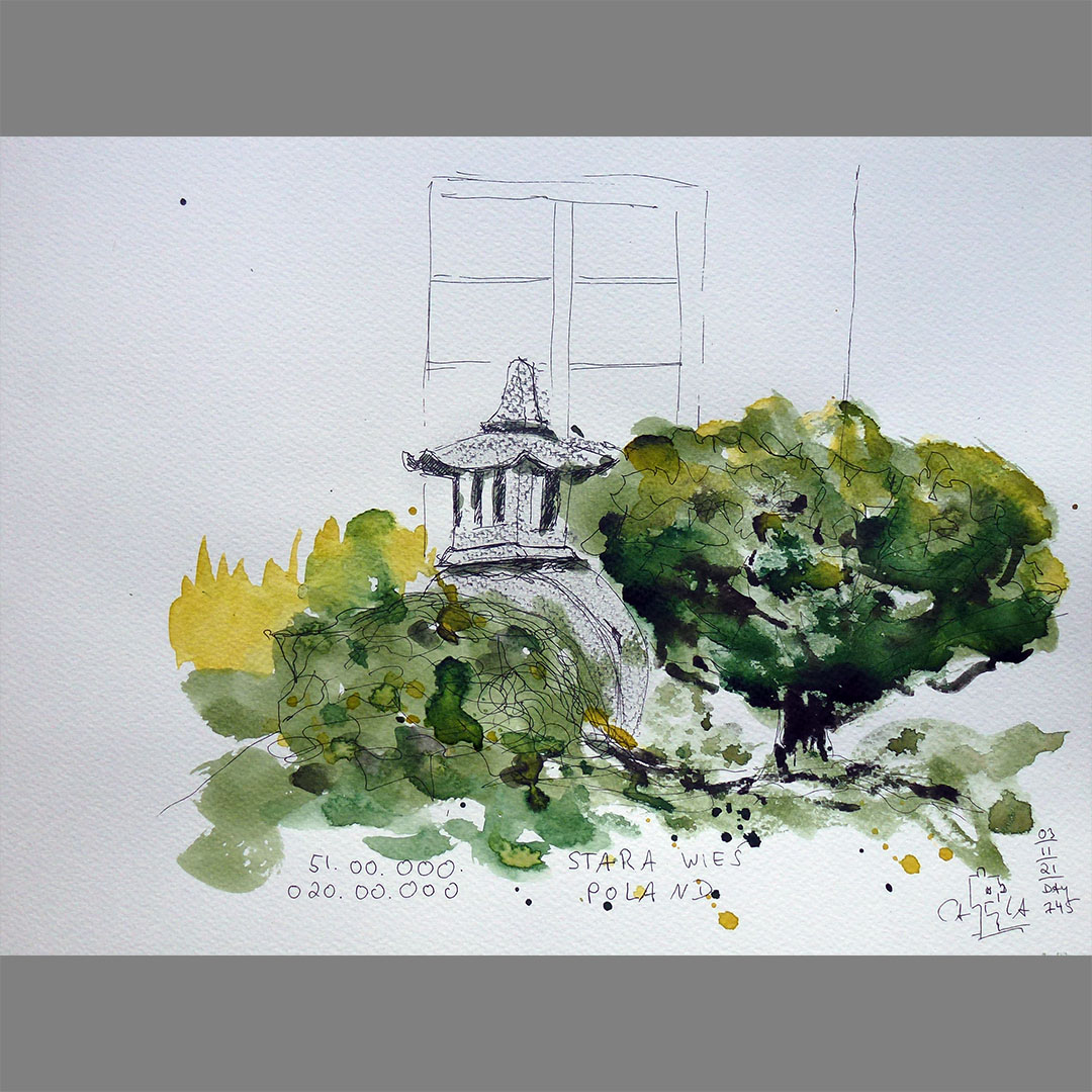
Dojo Stara Wieś
The way to my next stage destination N51.00.000 E020.00.000 on my virtual bike trip leads over the last few kilometers through a large forest area and a few hundred meters before my destination through the area of Dojo Stara Wieś, the world’s largest performance training centre for Far Eastern martial arts and sports. But the place is more than just a training center. The website says:
"Integrated into the magnificent landscape of fields and woods, Dojo delivers tranquility and a sense of harmony to its guests. The Japanese design, space and quiet offer the opportunity to recover from the rigors of everyday life, to restore calmness, to gain some distance and to achieve the balance that is essential in life. Dojo is exactly what the name says – the place where you can begin your own journey."
This description fits very well with my virtual bike trip, the basic idea of which goes back to my real bike trips. For me, with all the physical exertion and with the reduction to little luggage and ballast, this meant exactly that: "restore calmness, gain distance".

Chełmce
On the way to my next stage destination N51.00.000 E021.00.000 on my virtual bike trip I notice a manor house halfway in Chełmce that looks like a lost place with a new annex. It was built around 1540 as a tower house with 2 wooden side wings. Over time, the owner changed frequently. After the mansion and village were burned down by the Russians in 1864, a staircase and porch on the first floor were added, but the wings were never reconstructed. Around 1915 the house was used as a school. In 1956 the wooden verandas and the stairwell with the main roof were destroyed by fire and the mansion fell into disrepair and was supposed to be demolished. In 1991 the house was bought by an architect and reconstructed for residential purposes before it changed hands again in 2014.
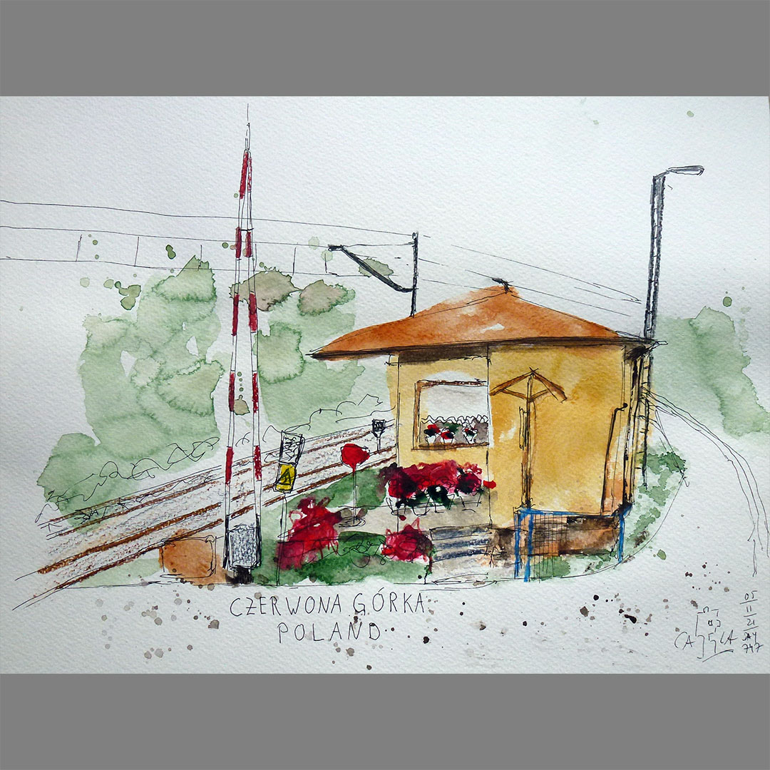
Czerwona Górka
The further way on my virtual bike trip leads alternately through extensive forest areas and villages. A few kilometers before my next destination, the path leads along a railway line where someone has set up a gatekeeper's house in a cozy domicile with curtains and flowers on the small terrace.

N51.00.000 E021.00.000
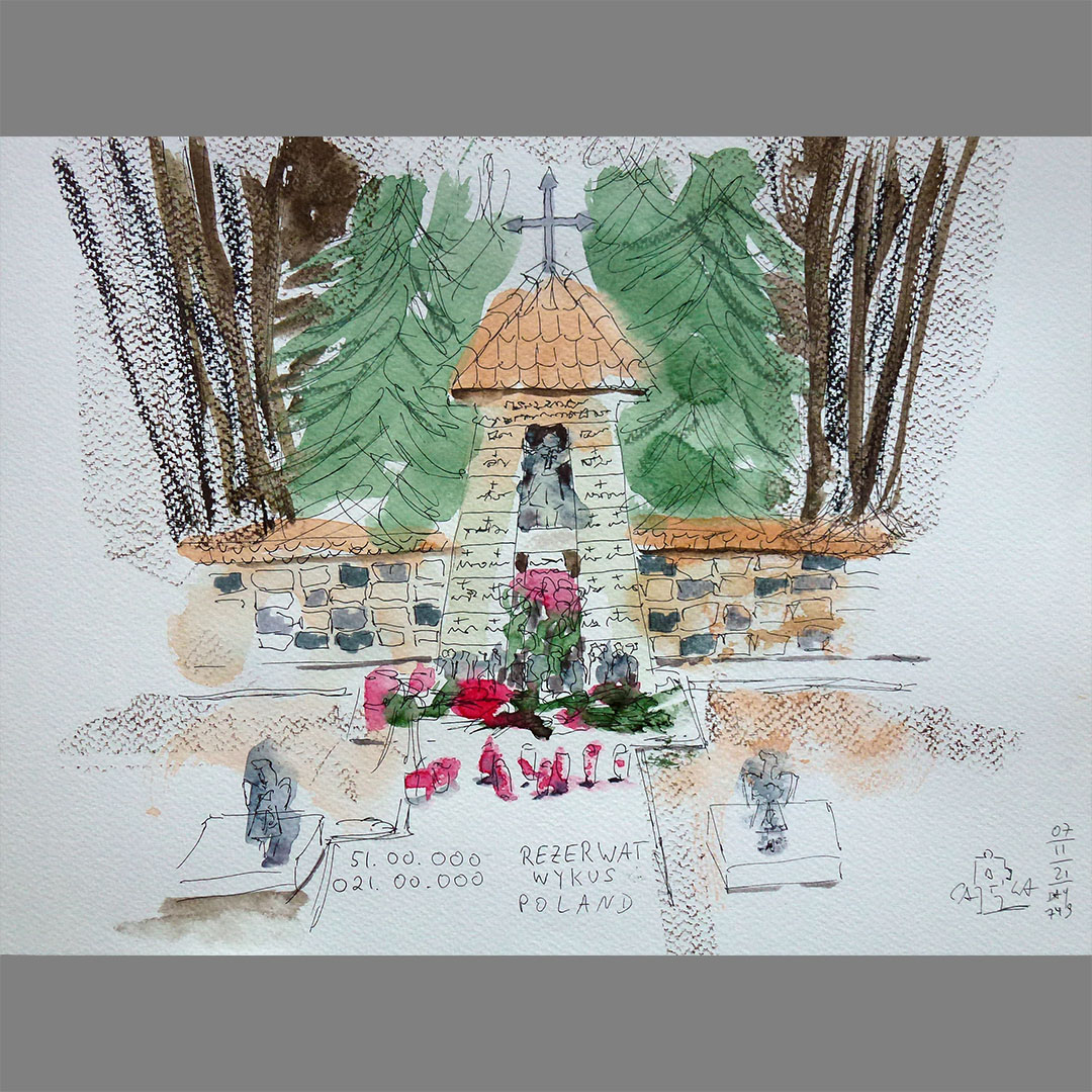
My next stage destination N51.00.000 E021.00.000 is in the middle of an extensive forest, the Wykus reserve. Near the confluence point, on an area that used to be a soldiers' camp, there is a memorial for Polish soldiers who died in World War II. There are also partisan graves in various places in the forest.

Radkowice-Kolonia
In 1962 this historic wooden church was moved here from Miedzierza (Mniów municipality). It was built in 1621 and was under the parish of Radoszyce. Over time, however, it has been abandoned and neglected. In 1864 this church became a parish church, but it soon turned out to be too small. At the beginning of the 20th century, a new brick temple was built next to the wooden church. The historic building fell into disrepair until 1957 when the residents of Radkowice bought it and moved it to their town. It took several years to assemble the building. The work was completed in 1962 and the church was consecrated a year later.
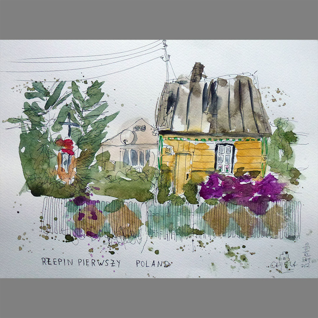


Rzepin Pierwszy
The further way on my virtual bike trip to my next destination N51.00.000 E022.00.000 leads through a village, as I have often seen on the last stages, a long street with rows of houses on both sides, but no side streets and no central squares. The buildings show a multitude of different architectural styles, from the original wooden houses to modern, spacious single-family houses, some of which were even demolished in the middle of construction, which reflect that the village has grown over decades. In this village there are a few beautiful old wooden houses, some with elaborate decorations and glazed porches, surrounded by overgrown gardens. Sometimes there are old houses like this on the sites close to the street, apparently abandoned, with outbuildings behind them, maybe stables, or a newer house was built behind the old one. Many older houses have a well on the property, some of which seem to be still in operation.
Locations:
https://goo.gl/maps/BViYUYRaenLB4WC36
https://goo.gl/maps/JRgZGdLX58n1YTVFA
https://goo.gl/maps/hU6KLabLEL1gNacq8
https://goo.gl/maps/5HcaAfLdzNauUE1s6
https://goo.gl/maps/q8VSnCwkkQi6GLGG7
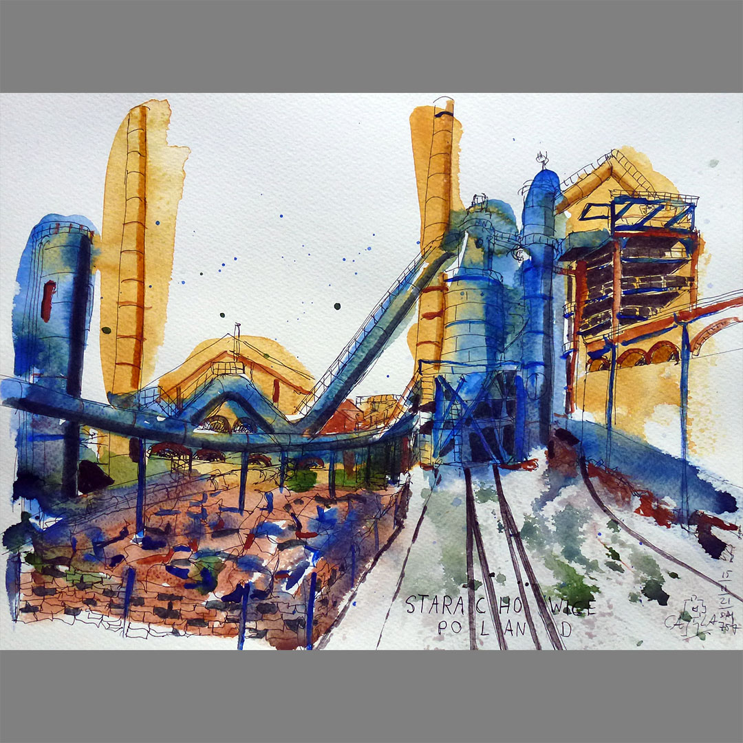
Museum of Nature and Technology in Starachowice
On the map, a few kilometers away from my virtual bike route in Starachowice, I discover a museum of nature and technology, which is located on the site of a former steelworks from the 19th century. In addition to the factory's preserved buildings with blast furnace, water tower and some halls, an old ironworks settlement, exhibits on ore mining in the area and an extensive exhibition of vehicles from the Polish truck factory "Star" can be viewed there. An extensive palaeontological exhibition is also located on the premises.


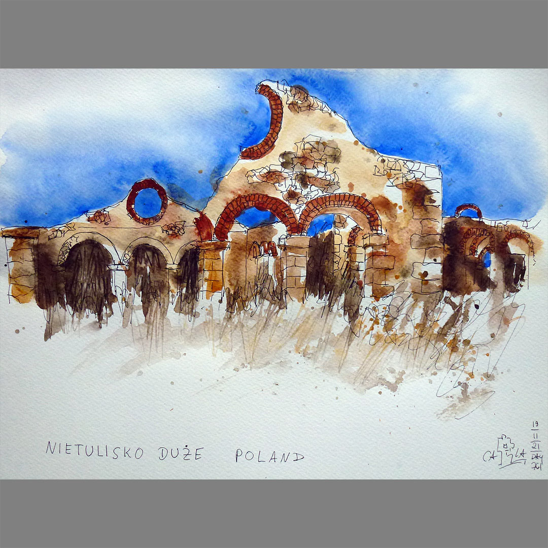
Nietulisko Duże
In Nietulisko Duże, my virtual bicycle route leads near the ruins of an iron rolling mill from the 19th century. The region was rich in natural resources and several steel and iron processing plants were built along the Kamienna River. The blast furnace on the site in Starachowice, which I had visited virtually 4 days ago, was also part of the complex of factories.


Ostrowiec
The further way on my virtual bike trip to my next stage destination N51.00.000 E022.00.000 leads along the southern edge of an industrial area in Ostrowiec. The city used to live mainly from the steel industry and there are still some steel processing companies in the industrial area. In addition, a number of old factory buildings are falling into disrepair alongside properties that have already been built with new halls. The industrial area is overlooked by a water tower that is falling into disrepair, as are several of the old factory buildings in the area.
On the outskirts of Ostrowiec there is a house with a turret architecture. It belongs to a company closely associated with the city's steel processing industry that makes refractory products. On the site with several historical halls there is also an old, restored water tower, which was probably the model for the large and small turrets on the building.
Locations:
https://goo.gl/maps/sCzY55zmuiQ2nxob9
https://goo.gl/maps/FWJBevUipKLDNGW3A
https://goo.gl/maps/f2M3yGno2uSFJkuq6
https://goo.gl/maps/oswZgiPVZHZRXCsv6
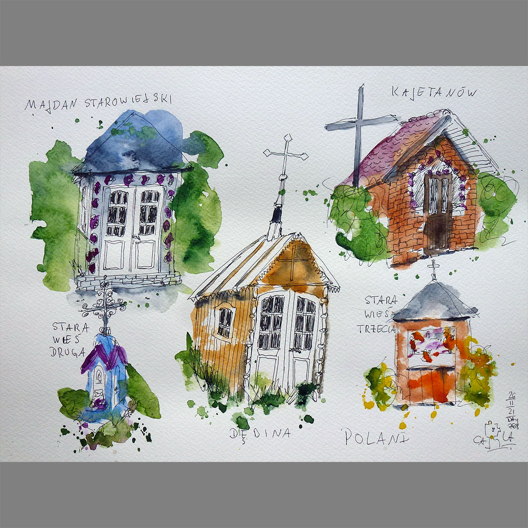
Wayside shrines
On the way to my next stage destination N51.00.000 E023.00.000 there is a wayside shrine in almost every small village on my virtual bike route, some a bit larger and accessible, others are as small as a doghouse or consist of a cast column with a cross.
Locations:
https://goo.gl/maps/he9Jn5Pm9yP9gNLp7
https://goo.gl/maps/yCEHrVot38tbK4qy8
https://goo.gl/maps/RyV2BP2tzpnTNySH9
https://goo.gl/maps/pd54zkECNHvQRJwo6
https://goo.gl/maps/L1hJCmFkhTiCiARn8

Sobieska Wola Pierwsza
In Sobieska Wola Pierwsza, my virtual bike route leads near a mansion from the first half of the 19th century. The building once belonged to a large estate with numerous farm buildings, stables, barns and a mill, the origin of which goes back to the 2nd half of the 15th century. Over time, the owners changed from time to time, partly through sale, partly through inheritance and the lands were parceled out. After World War II, the manor house was used by the state, the remaining farm buildings fell into disrepair and were demolished. The building has been privately owned since 2003 and is being restored.
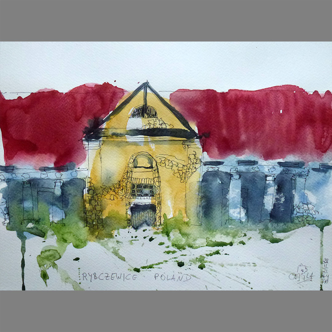
Rybczewice
In Rybczewice, on my virtual bike route, I discover some abandoned buildings that once belonged to an estate. Some buildings are just overgrown ruins, two buildings have relatively new roofs that protect them from further deterioration. They date from the first and second half of the 19th century, one was a cowshed, the other, with a front with columns and arcades, was a granary.