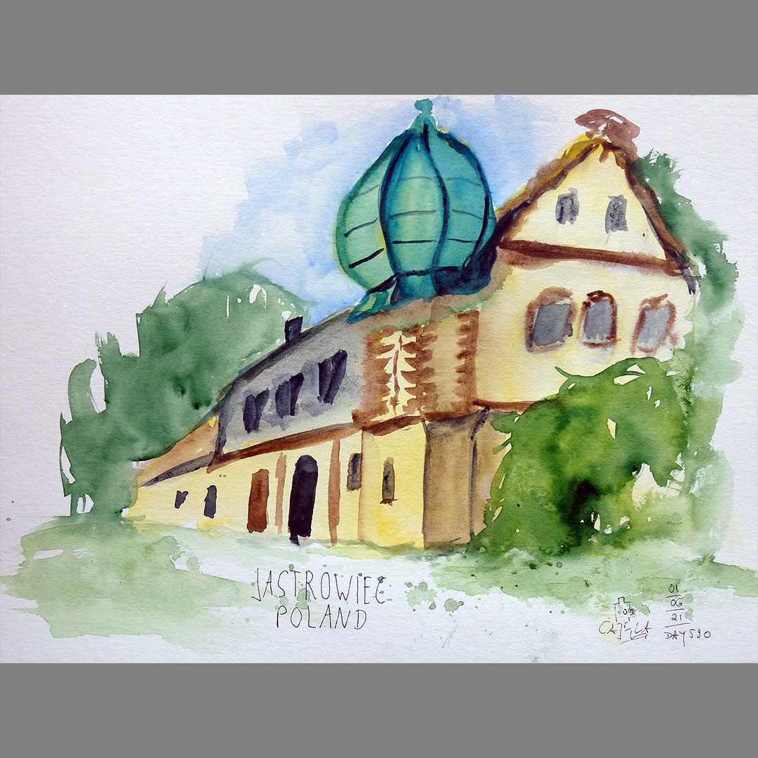
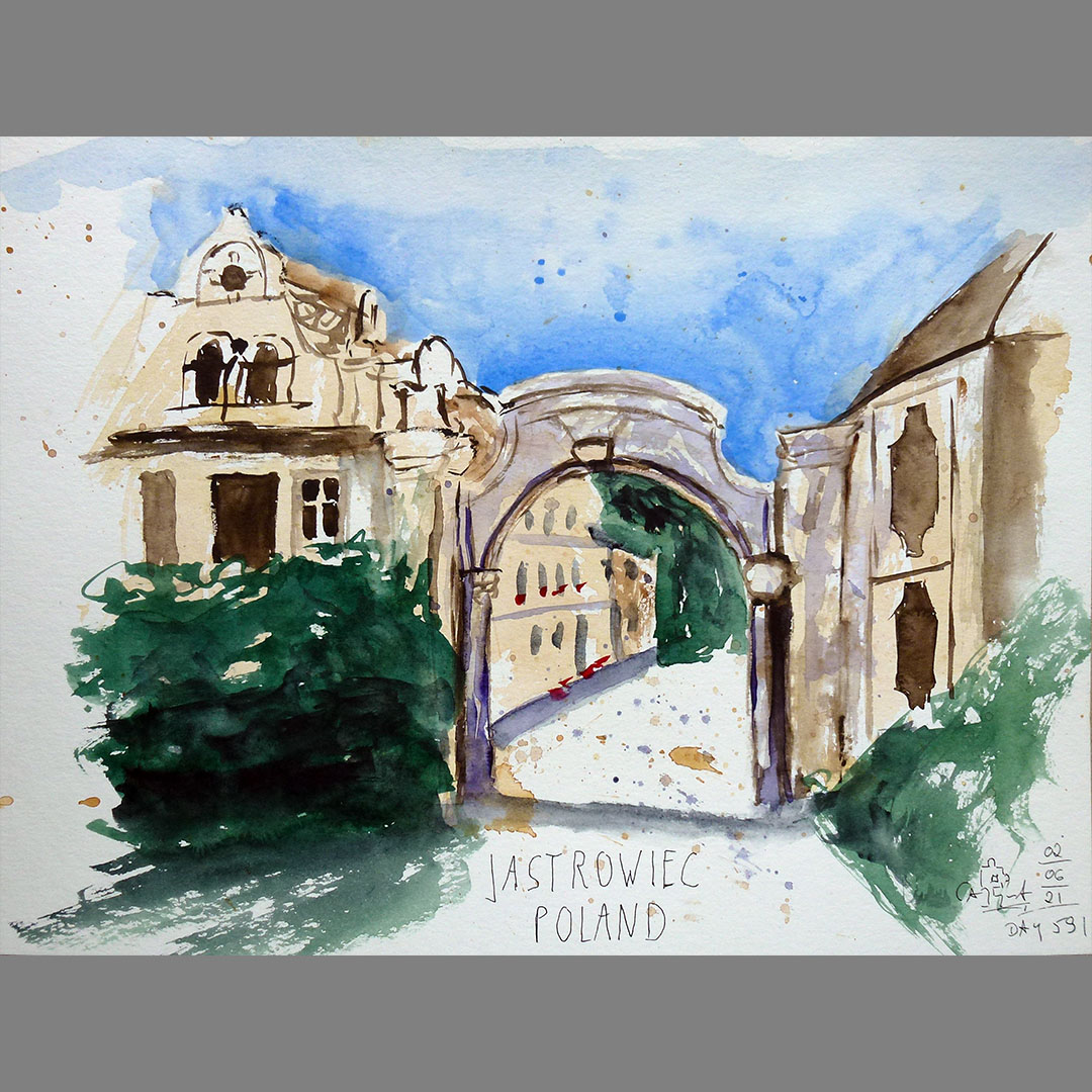
Jastrowiec
On the way to my next stage destination N51.00.000 E017.00.000 on my virtual bike trip, after a few kilometers in Jastrowiec (until 1945 Lauterbach) I come across another castle, which advertises B&B accommodation with a sign on the roadside. The castle was built around 1650 and extensively rebuilt in the 18th century. After the Second World War it was used as a publicly owned farm until the mid-1970s. It then fell into disrepair until it became private property in 1989. There are several farm buildings on the castle grounds, of which I particularly like one with an interesting tower as a motif.
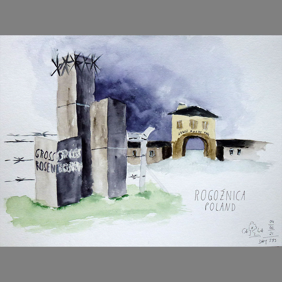
Rogoźnica / Gross-Rosen
Just a few hundred meters from my virtual route, I notice an entry on the map, Muzeum Gross-Rosen. It is the former Gross-Rosen concentration camp, which is now a memorial and commemorates a terrible chapter in our history. Some buildings have been preserved or faithfully reproduced on the site, and a museum with an exhibition documents the history of the camp complex.
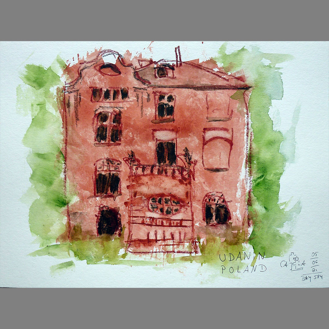
Udanin
About halfway to my next stage destination N51.00.000 E017.00.000 on my virtual bike trip I notice an imposing abandoned house between the villages of Piekary and Udanin, beautifully aged, located in a small overgrown park. I can't find out anything about the house. But the weathered, dark red paint appeals to me to draw a quick sketch of the reverse side with watercolor chalk on a patch of color created with a large brush.
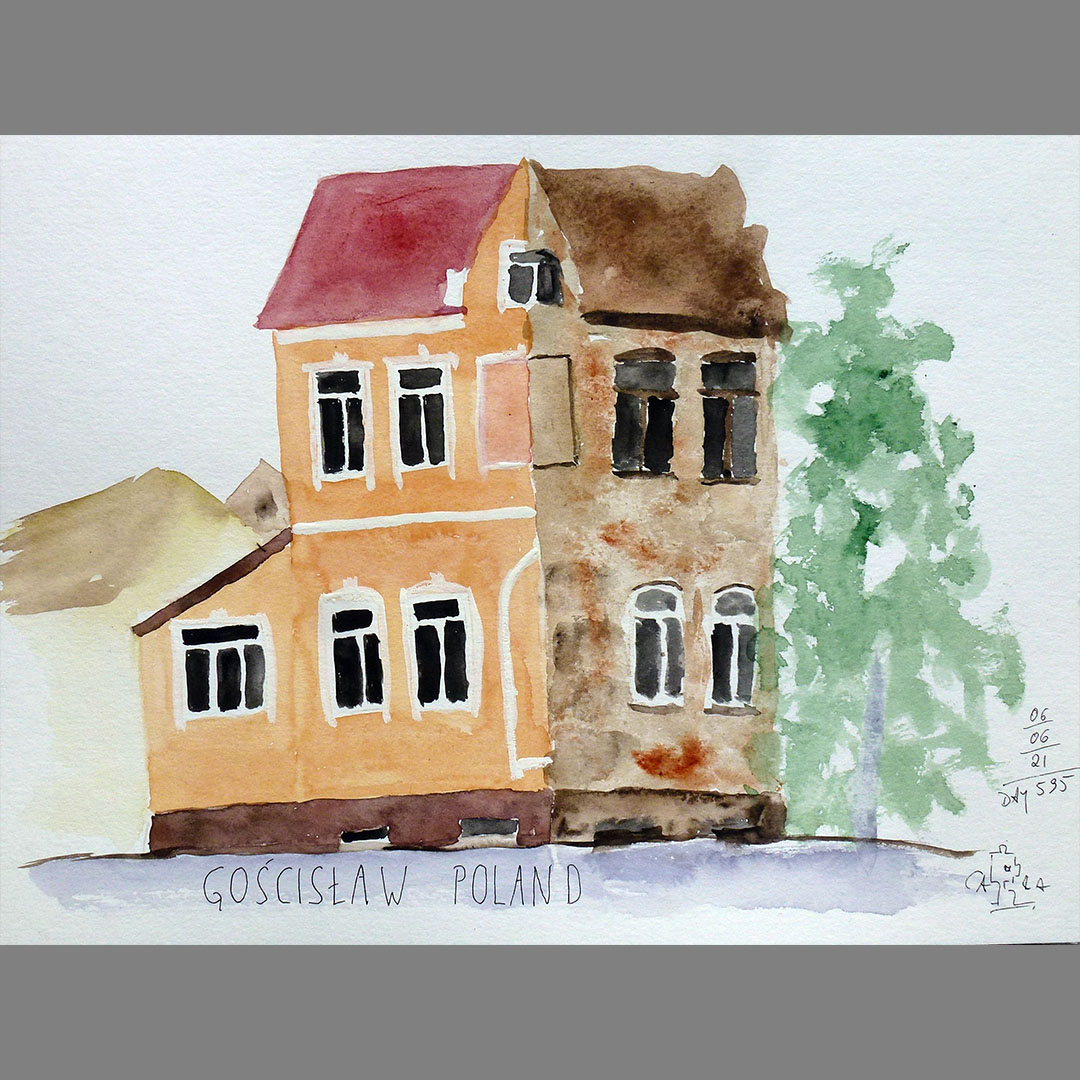
Gościsław
In Gościsław I take a wrong turn and follow the street view pictures through the village, although my virtual bike route, which is not illustrated here, leads along the edge. In the village, between some neglected and abandoned buildings, a newly renovated one stands out, with pretty architectural details, but actually nothing special. If it weren't for the time warp that runs right through the house across the street. It's just a jump to the left and then .....
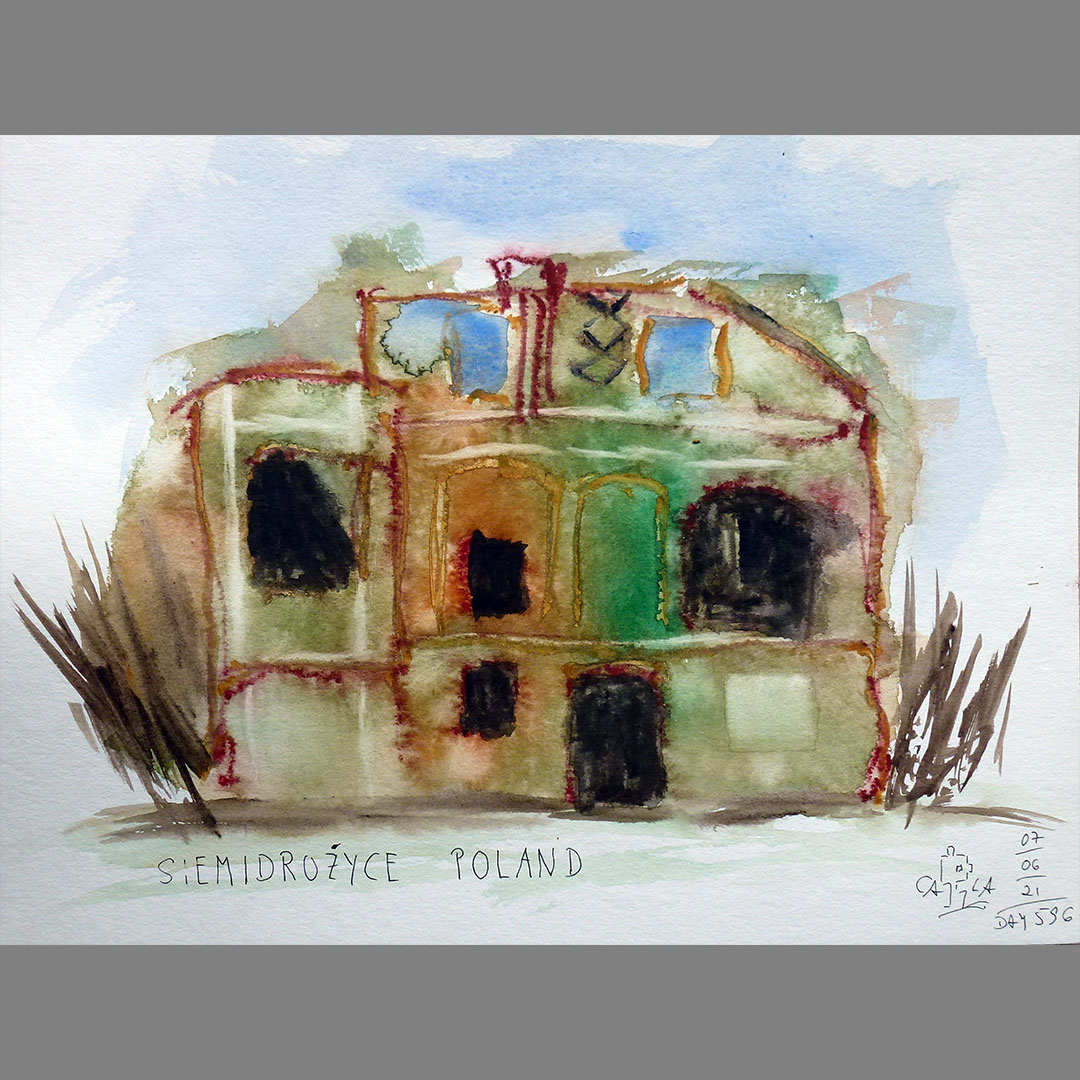
Siemidrożyce
In Siemidrożyce (until 1945 Schöbekirch), a tiny village a few kilometers further on my virtual bike route, I am once again attracted to a lost place, to capture the play of colors in the old walls with a large brush and a few quick strokes with watercolor pencil. The former manor house was built in 1853 and you can still see beautiful architectural details even in the ruins. Some of the farm buildings on the estate are still inhabited.
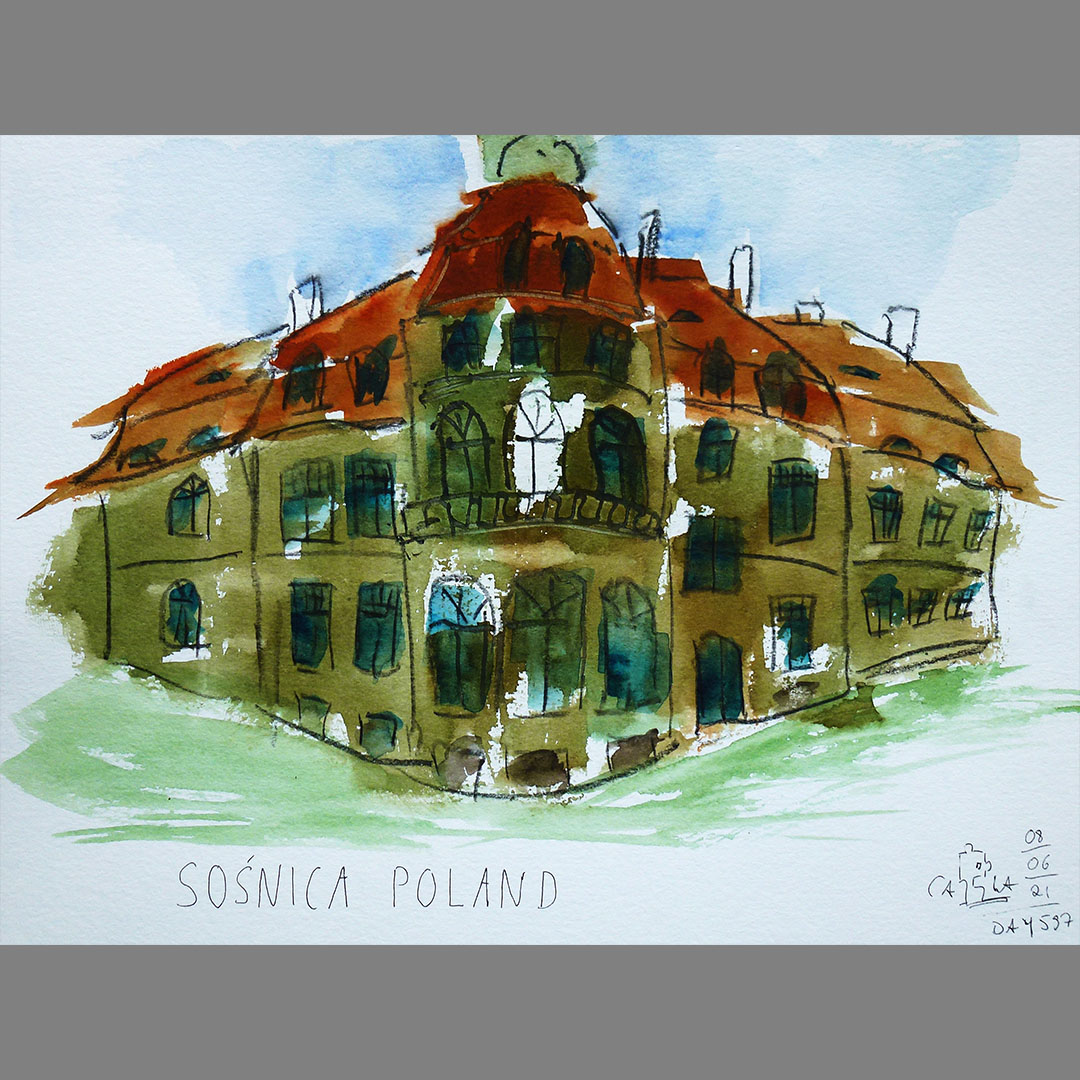
Sośnica
In Sośnica (until 1945 Schosnitz) my virtual bike route leads directly through a castle area. The castle was built in 1810, is in pretty good condition and is still inhabited, only looks a bit neglected in some places. There is also a large ruin on the site, possibly an older castle that was built there in the 17th century.
I have to try again the surprisingly pleasant color mixture of a bright titanium red and a screaming shade of green from my picture from yesterday on the castle.
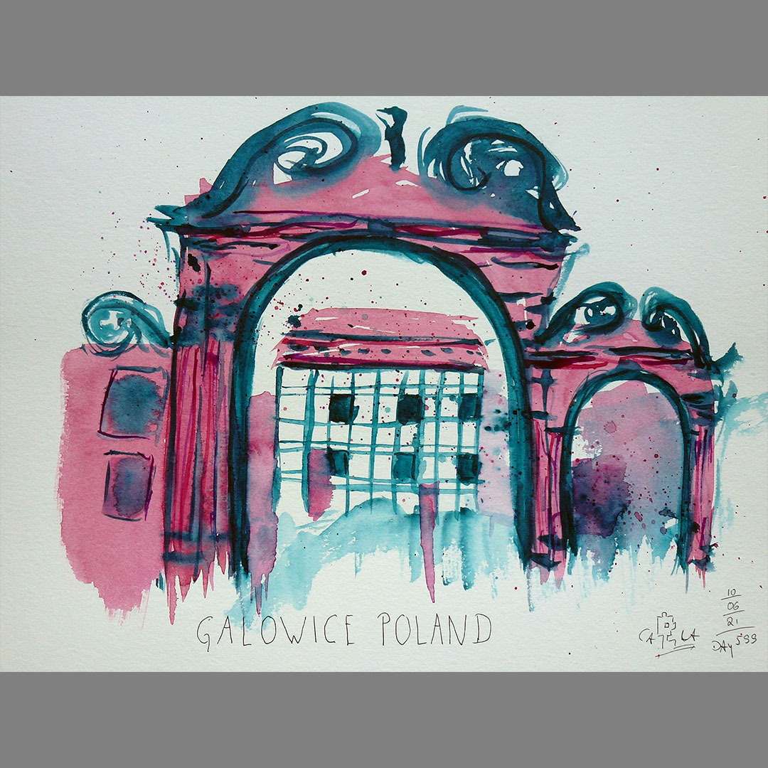
Galowice
On the way to the next confluence point N51.00.000 E018.00.000 I notice a carriage museum in the first village on my further virtual bike route. The speed of travel in a horse-drawn carriage used to be similar to that of a bicycle. I doubt whether you could enjoy the landscape on a horse-drawn carriage back then, the roads were probably pretty bad. The picture gallery on the museum website and on google show a lot of exhibits, but I am more inspired by the archway at the entrance to the site to play with bold colors.

Okrzeszyce
In Okrzeszyce, as in many places on my previous virtual bike route, I notice the juxtaposition of new or beautifully renovated buildings and old, extremely shabby houses, where you can sometimes only tell from the flowers in the window that they are still inhabited. Even if new and carefully renovated houses look more homely, the walls of the old buildings, where the plaster is peeling off or even the stones are crumbling, with their play of colors and structures are much more interesting for drawing and painting.
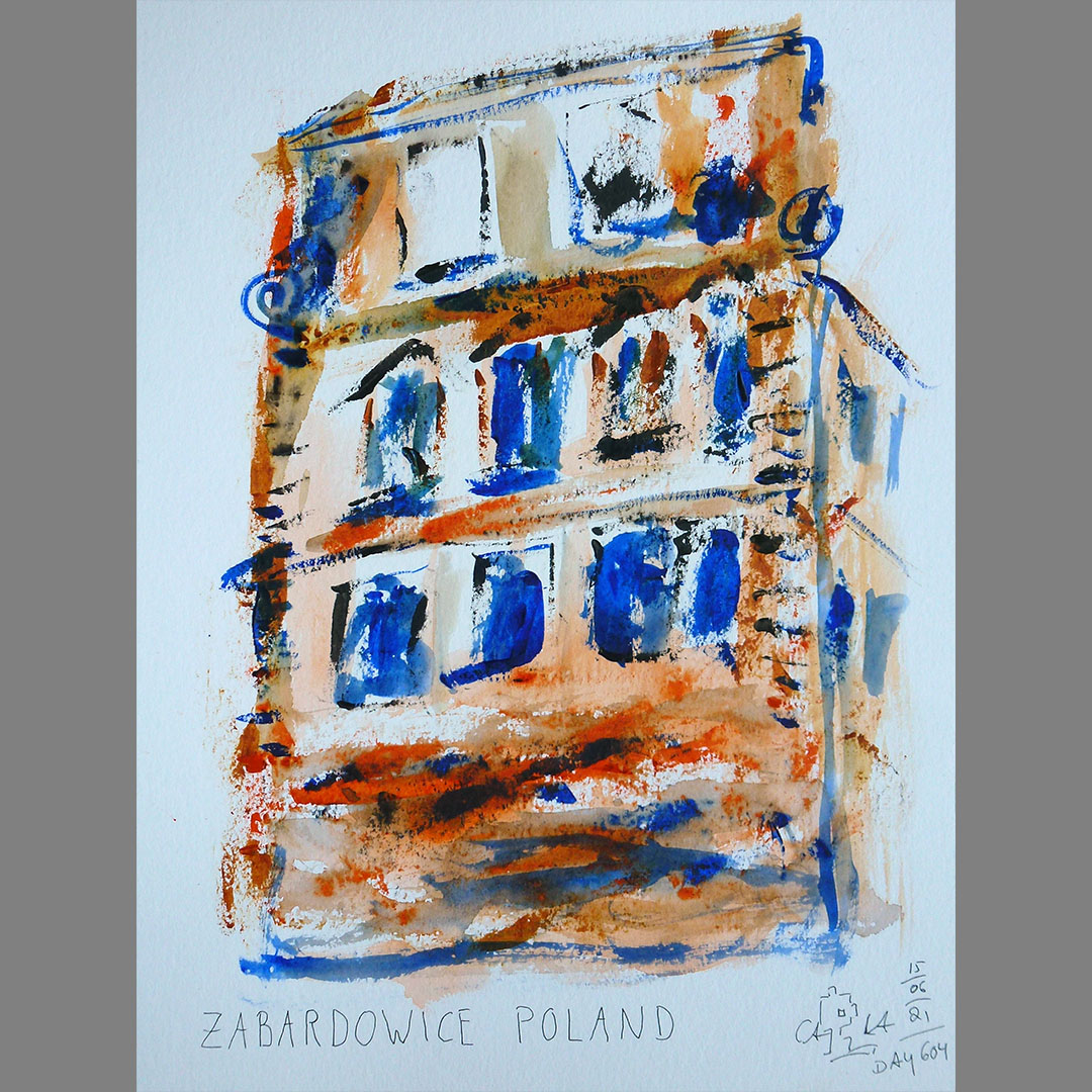
Zabardowice
In Zabardowice I notice another castle ruin. The castle was built at the end of the 19th century and, like so many others, became state property and fell into disrepair after World War II. In 2005 it was listed and in 2009 the roof was renewed. In 2013 it was sold to a private owner who was planning a hotel with a rehab facility. In April 2019, the building was badly damaged by fire.
The crumbling gable wall inspired me to trowel remnants from watercolor tubes with a painting knife.
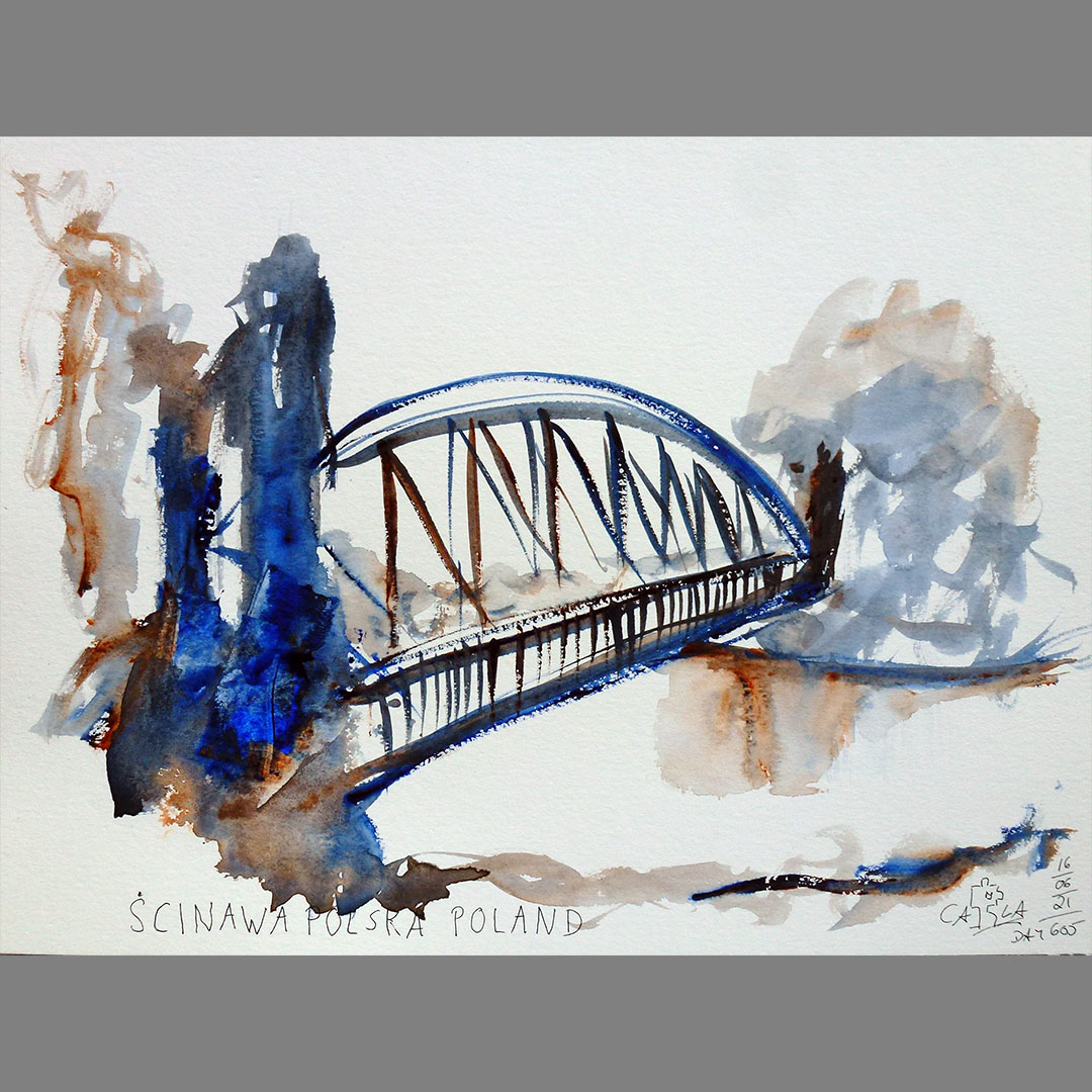
Oława / Ścinawa Polska
In Oława (until 1945 Ohlau) my virtual bike route leads over the Oder. However, there is a much nicer place on the border to the neighboring town of Ścinawa Polska to cross the Oder over an island located in it. The small bridge with the mighty bridge portals looks as if it was once built for vehicles that are significantly heavier than bicycles. On the other hand, it is much too narrow for large vehicles.
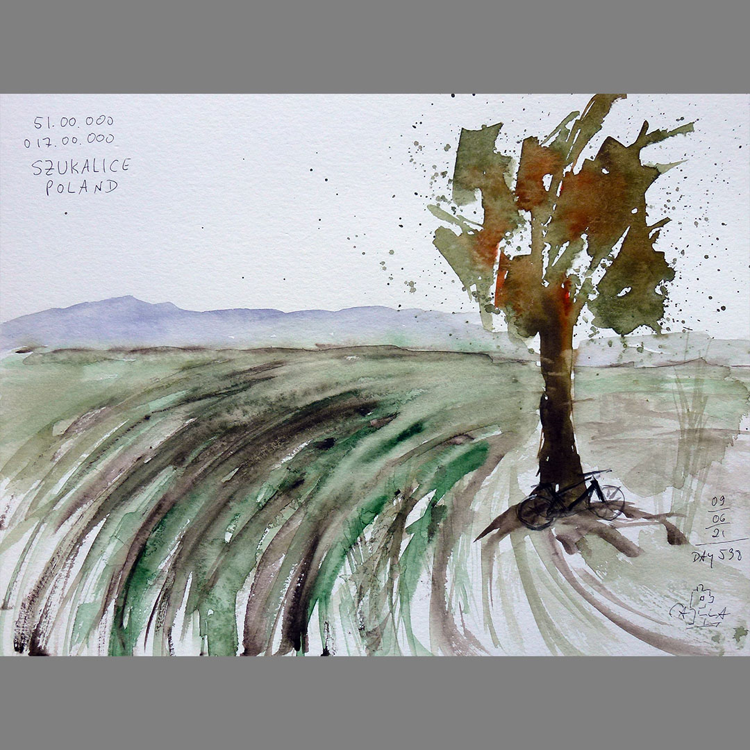
N51.00.000 E018.00.000
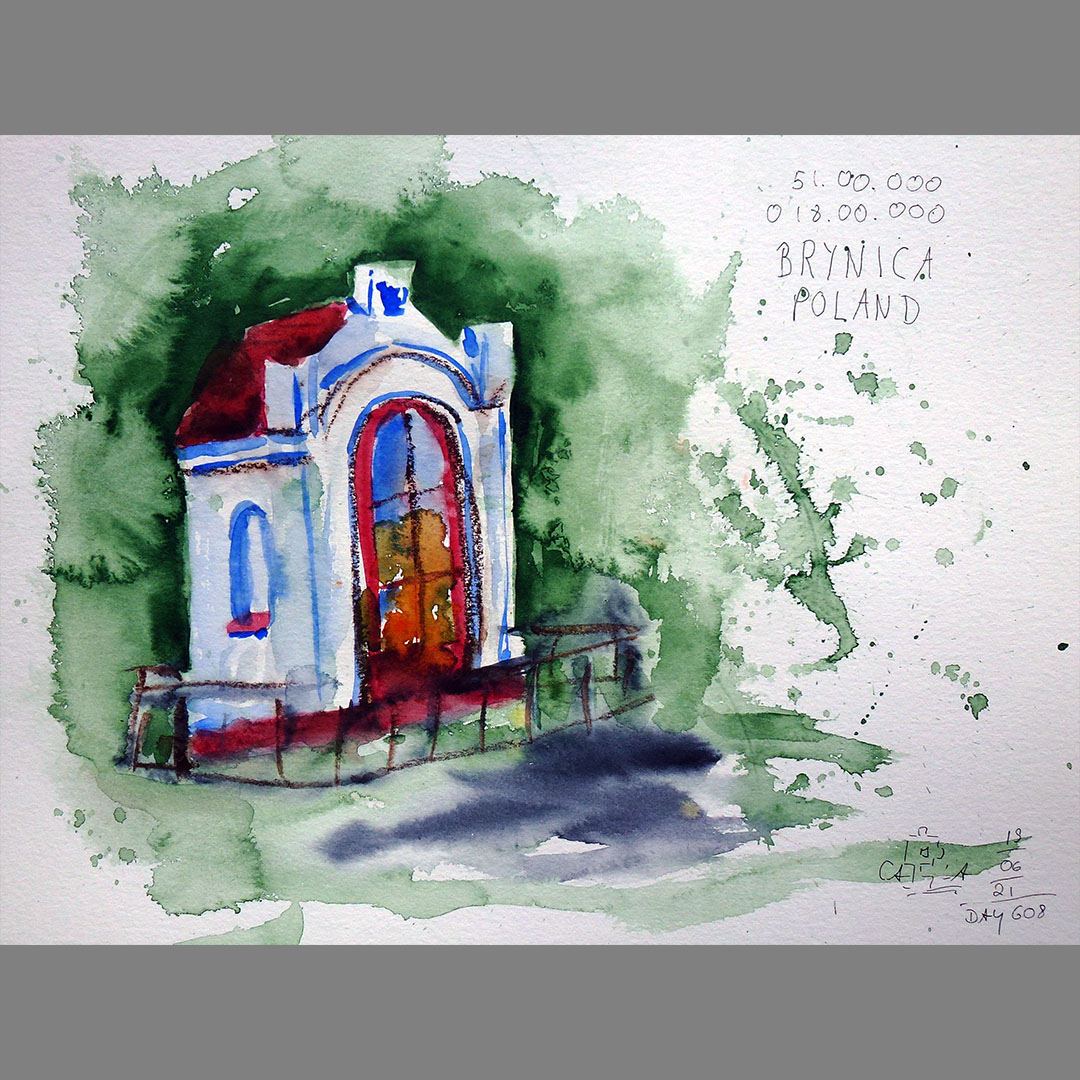
The next 40 km to my stage destination N51.00.000 E018.00.000 on my virtual bike trip lead through a very rural area with many fields and a lot of forest. The point of confluence is also in the forest a few meters from a narrow road. A few hundred meters before, on the outskirts of Brynica (until 1945 Kiefernhain = pine grove - the name says everything about this place) I noticed a small chapel.

Wąsice
On the way to my next stage destination N51.00.000 E019.00.000 I notice a transformer tower with bright blue doors in Wąsice. In my home region there are still such transformer towers in rural areas, but they are no longer in operation. They are often used as conservation towers, with nest boxes for birds and hiding places for bats. Looking at the above-ground power supply, I wonder how often the power fails here during thunderstorms or storms.

Bąków
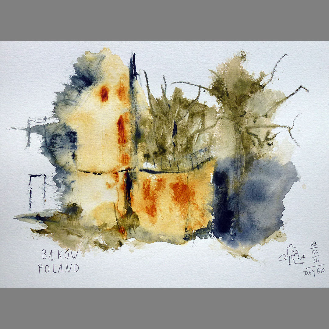
In Bąków my virtual bike route leads past an abandoned castle from the first half of the 19th century, which looks a bit neglected but hardly shows any damage caused by vandalism. The castle was privately owned until 1943, after the Second World War it was nationalized and converted into an apartment building. The castle stands in a rather neglected landscape park and is in places already recaptured by nature.
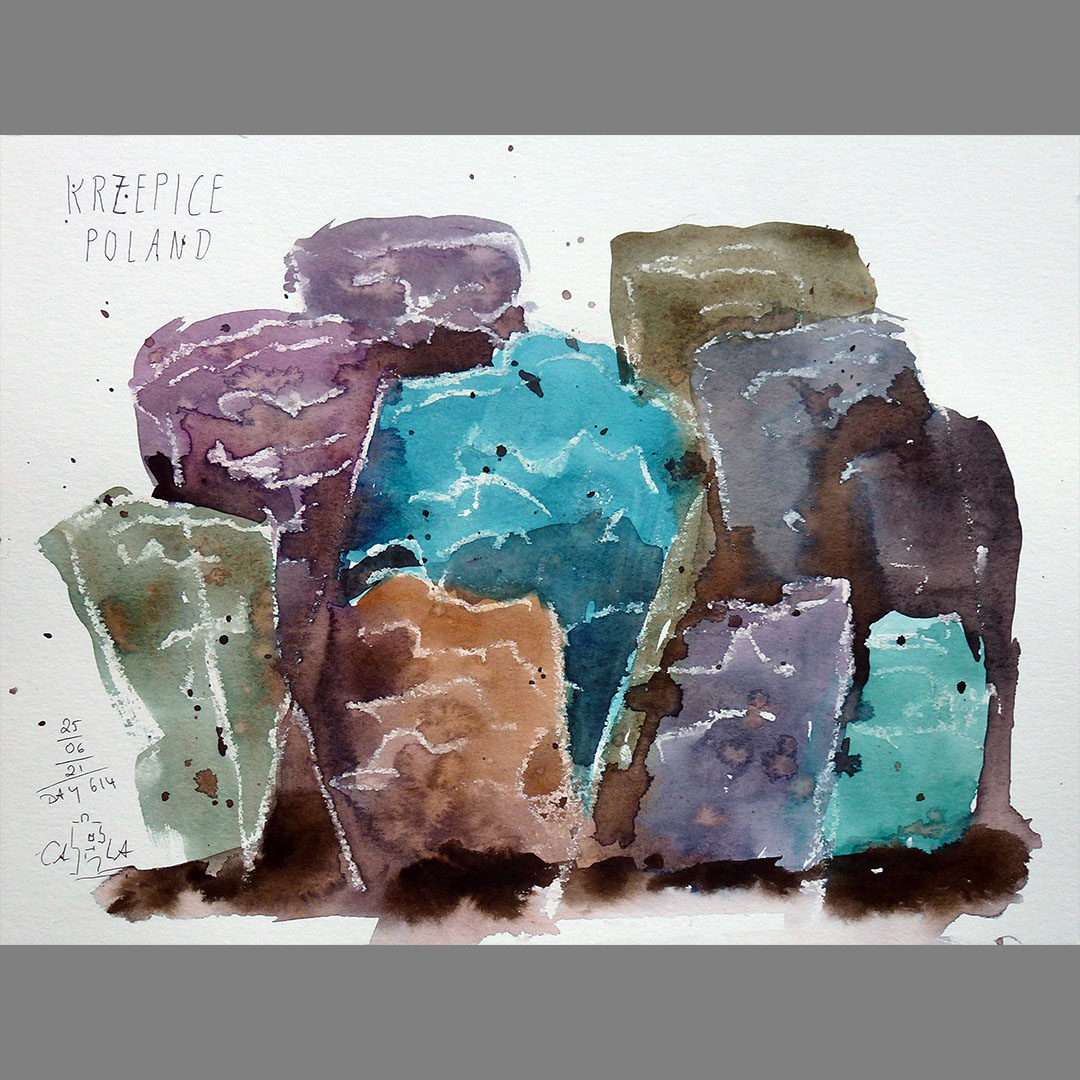
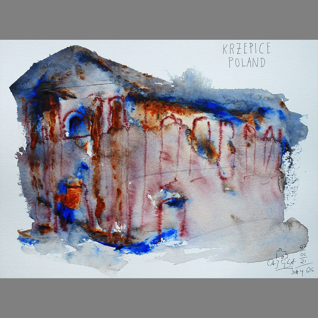
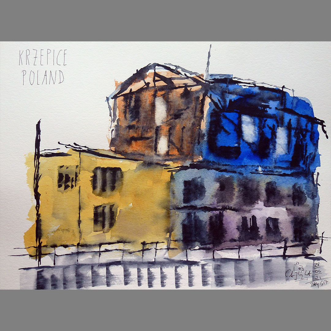
Krzepice
On the outskirts of Krzepice, I notice the entry for a Jewish cemetery on the map, which is at the end of a dead-end-road in a small forest. The cemetery was built around the turn of the 17th and 18th centuries. Century and is one of the largest collections of cast iron matzevas in Europe. The cemetery was devastated after the Second World War and some matzevas were also sold as scrap metal. In 1997, a group of students began clearing the cemetery from undergrowth and cataloging the matzevas and tombstones. 402 cast-iron matzevas were recorded. In 2000, an initiative by students from local and Warsaw schools began with the extensive restoration of the matzevas and tombstones.
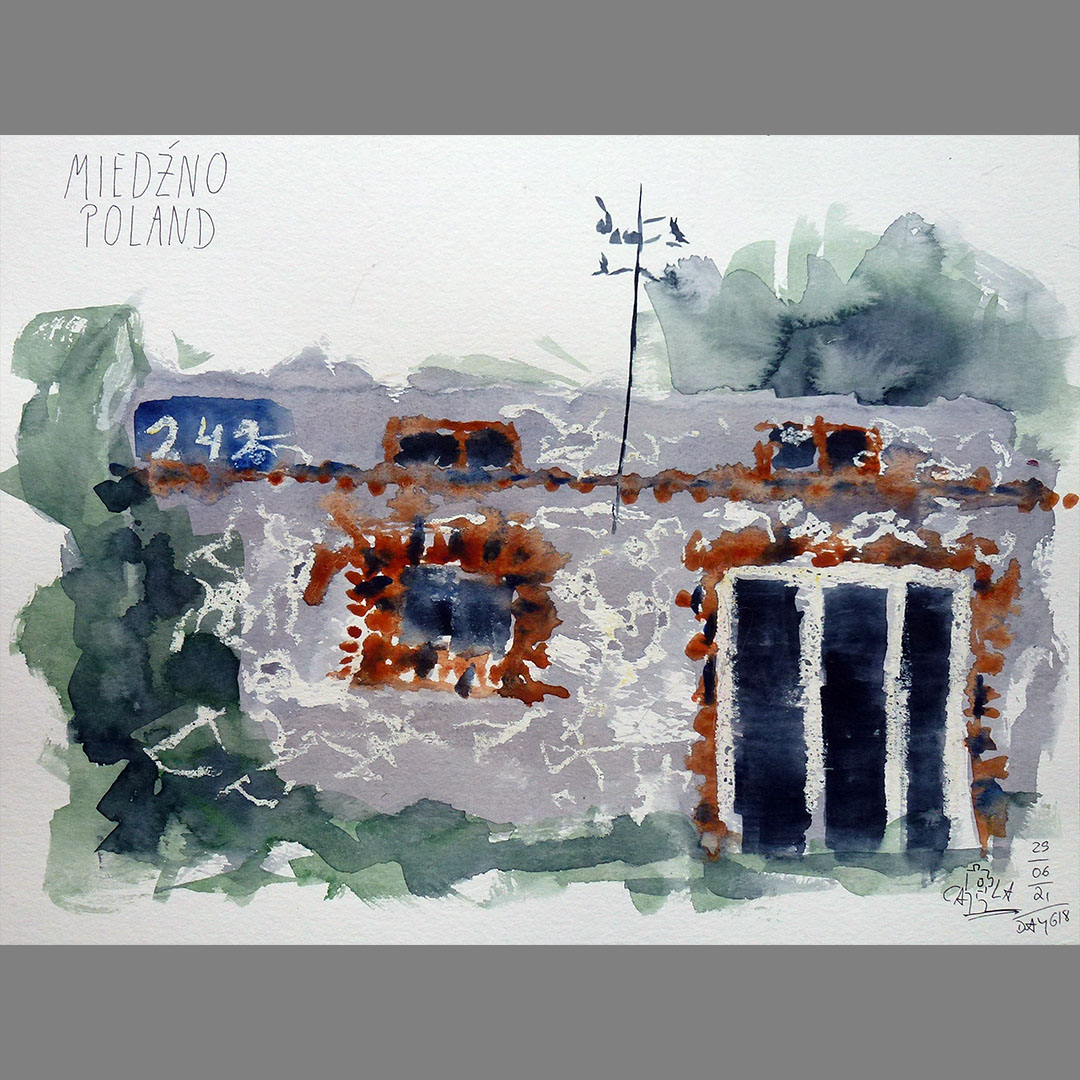
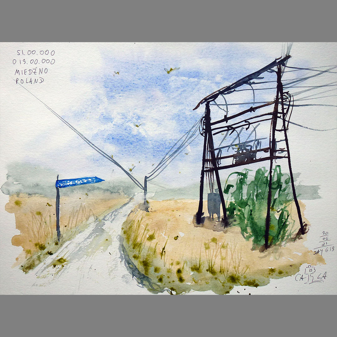
Miedźno
On the last kilometers to my next stage destination N51.00.000 E019.00.000 there are only a few houses on the street, including a ruin that must come from a time with a different assignment of house numbers. Directly next to the building with the number 242 is a newer, inhabited house with the number 164.